Project Background
Project Description
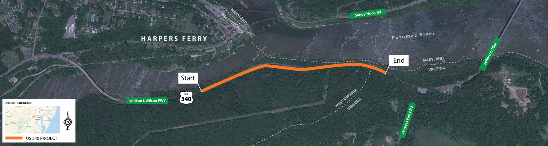
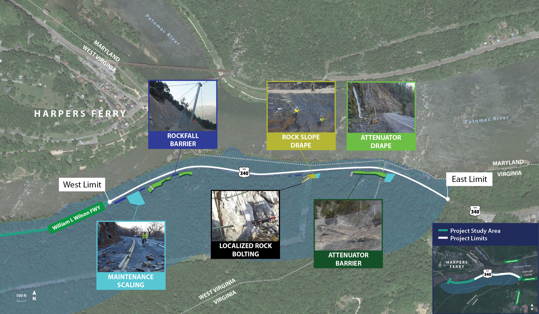
The project study area is located along the northbound (NB) and southbound (SB) lanes of US 340 in Jefferson County, WV, in the Loudoun Heights region of the Harper’s Ferry National Historical Park and west of the West Virginia / Virginia border on the southern bank of the Shenandoah and Potomac Rivers. US 340 is a high-traffic volume corridor serving local, commuter, and truck traffic from West Virginia, Virginia, and Maryland. This corridor also experiences high traffic volume from seasonal tourism due to its recreational and historical significance in the region. The existing cut slopes in the project study area are a product of US 340 construction in the mid-1950s and natural erosion along the Shenandoah River. The cut slopes and the exposed rock of natural slopes vary in height from 150 feet to greater than 300 feet above the roadway. The cut slopes in the project study area exhibit varying degrees of rockfall activity that present potential hazards to the traveling public, and require ongoing maintenance by the West Virginia Division of Highways (WVDOH).
Purpose:
The purpose of this project is to implement rockfall protection and stabilization measures associated with the existing slopes along US 340 NB, while considering local traffic impacts and future development of the US 340 corridor.
Need:
Due to the high volume of traffic, and that US 340 is the main route through this area, rockfalls pose a threat to public safety. Not only from the rockfall itself, but from road closures that result from rockfalls, and the potential impact to emergency vehicle response times. Based on the analysis in a design study prepared in April 2018, there is a high potential for rockfall in the area and an established public safety need to implement rockfall protection and stabilization mitigation measures for the priority slopes.